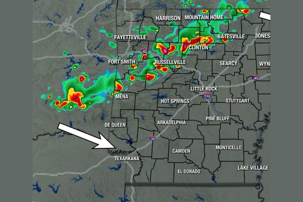
ARKANSAS — There is pretty good model signal for a few storms Friday, perhaps an afternoon and evening round, across northern Arkansas including Harrison, Mountain Home, Batesville, and Fayetteville. Severe weather will be possible, mainly strong winds or hail. Much like the previous day, storms will likely be scattered rather than a statewide event, though just enough upper-level wind across the northern half of the state could allow storms to organize.
Scattered Storms Expected During Afternoon and Evening
Model guidance shows good signal for storms developing Friday, with an afternoon and evening round expected across portions of Arkansas, particularly concentrated across the northern half of the state.
Futurecast radar valid for 10:30 p.m. Friday shows organized storm activity near Harrison, Mountain Home, Batesville, and Clinton, with additional cells developing near Fort Smith, Russellville, and Mena.
Strong Winds and Hail Represent Main Severe Threats
Severe weather will be possible with Friday’s storms, mainly in the form of strong winds or hail, representing the primary hazards forecasters are watching as the system develops across the region.
Communities across northern Arkansas should prepare for the possibility of gusty winds and hail with the stronger cells, particularly in areas where storms have enough organization to strengthen during the afternoon and evening.
Upper Level Winds Could Allow Storms to Organize
Just enough upper-level wind is expected across the north half of Arkansas to possibly organize storms, a factor that raises the potential for more structured and potentially stronger cells compared to typical summer pop-up activity.
This organization potential is specifically tied to the northern half of the state, suggesting communities including Harrison, Mountain Home, and Jonesboro could see the most organized storm activity Friday.
Low Tornado Threat Uncommon for July Arkansas Weather
This setup could lead to a low tornado threat, which forecasters note isn’t common in Arkansas during July, adding an unusual element to what would otherwise be a typical summer severe weather day.
While the threat is considered low, its presence during a month when tornadoes are rare in Arkansas is enough to warrant closer monitoring as Friday’s storm system continues developing.
Scattered Nature Means Not Everyone Sees Storms
Forecasters emphasize this is not a 100 percent statewide forecast, with storms expected to remain scattered in nature similar to the pattern seen the previous day across Arkansas.
Communities including Little Rock, Hot Springs, and areas farther south and east may see limited or no storm activity Friday, even as northern Arkansas deals with the more organized and potentially severe cells.